
Drone Survey in Srinagar :
Drone Mapping & Survey in Srinagar.Srinagar is the largest city and the summer capital of the Indian state of Jammu and Kashmir. It lies in the Kashmir Valley on the banks of the Jhelum River, a tributary of the Indus, and Dal and Anchar lakes. The city is known for its natural environment, gardens, waterfronts and houseboats.
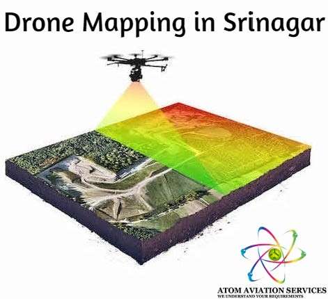
Drone Survey in Srinagar
Atom Aviation is doing class apart aerial Drone Survey in Srinagar with the help for photogrammetry and latest drones . Aerial Drone Mapping could be done with the help of Quadcopter and Fixed Wing Aircraft. The choice of platform depends on the requirements, the budget and the areas that need to be flown over. Image stablisation equipment helps to keep flight images sharp in low light or with fast moving subjects.
Pictures from the air can be taken from an oblique or vertical angle. They can be GPS referenced, taken as a panorama and tiled together if required.
Client groups include property marketing, design and advertising, construction, transport, tourism, government and PR. Please contact us for relevant samples.
India’s preferred commercial drone services provider.
Atom Drones is a premier drone, photography and video services company specialising in creating spectacular aerial imagery & data for businesses using the latest in cutting-edge drone technology.
What is Drone Mapping ?
Drone mapping is the art of taking photographs at regular interval over a large parcel of land. After clicking thousands of photographs all the photos are merged together to form a single image which is known as Orthomosaic or 2D map . In order to increase the accuracy of drone map, DGPS points are taken at regular interval. Those DGPS points are imported in ortho map and with the help of aerial triangulation , accuracy of map increases drastically. Atom Aviation has been Drone Survey in Srinagar since 2015.
What are the benefits of Drone Survey in Srinagar ?
Less Time & Less Cost- Capturing topographic data with a drone is up to five times faster than with land-based methods (like total station ) and requires less manpower. With PPK geo-tagging, you also save time, as placing numerous GCPs is no longer necessary. You ultimately deliver your survey results faster and at a lower cost.
Provide accurate and exhaustive data
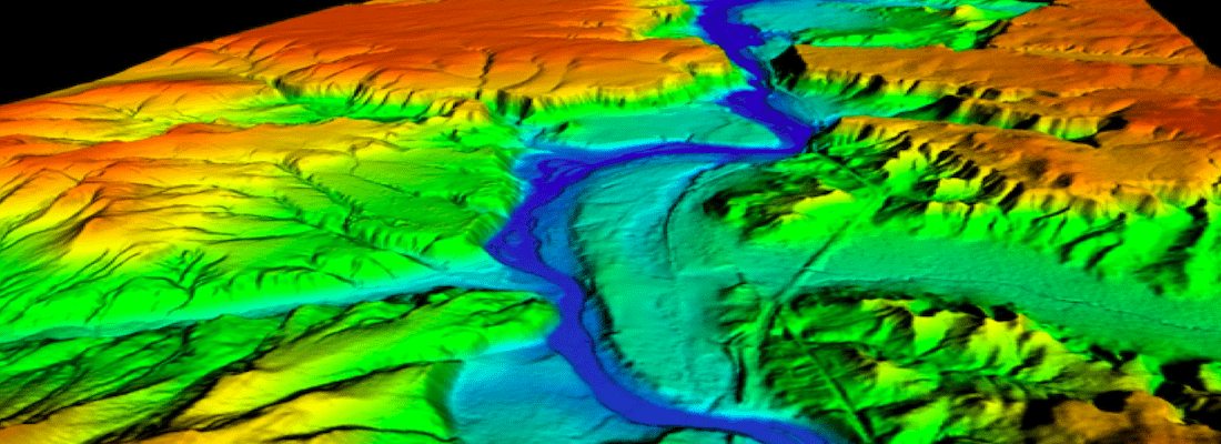
Total stations only measure individual points. One drone flight produces thousands of measurements, which can be represented in different formats (orthomosaic, point cloud, DTM, DSM, contour lines, etc). Each pixel of the produced map or point of the 3D model contains 3D geo-data.
Map otherwise inaccessible areas
An aerial mapping drone can take off and fly almost anywhere. You are no longer limited by unreachable areas, unsafe steep slopes or harsh terrain unsuitable for traditional measuring tools. You do not need to close down highways or train tracks. In fact, you can capture data during operation without any difficulties to other operations.
Where you can use the drone mapping ?
Land surveying / cartography
Survey drones generate high-resolution orthomosaics and detailed 3D models of areas where low-quality, outdated or even no data, are available. They thus enable high-accuracy cadastral maps to be produced quickly and easily, even in complex or difficult to access environments. Surveyors can also extract features from the images, such as signs, curbs, road markers, fire hydrants and drains.After post-processing with a photogrammetry software, these same images can produce very detailed elevation models, contour lines and breaklines, as well as 3D reconstructions of land sites or buildings. For eg Drone Survey in Srinagar is far easy as compared to hilly terrain.
Land management and development
Aerial images taken by drones greatly accelerate and simplify topographic surveys for land management and planning. This holds true for site scouting, allotment planning and design, as well as final construction of roads, buildings and utilities.
These images also provide the foundation for detailed models of site topography for pre-construction engineering studies. The generated data can also be transferred to any CAD or BIM software so that engineers can immediately start working from a 3D model.
As data collection by drones is easily repeatable at low cost, images can be taken at regular intervals and overlaid on the original blueprints to assess whether the construction work is moving according to plan specifications.
Precise measurements
High resolution orthophotos enable surveyors to perform highly-accurate distance and surface measurements.
Stockpile volumetric measurements
With 3D mapping software, it is also possible to obtain volumetric measurements from the very same images. This fast and inexpensive method of volume measurement is particularly useful to calculate stocks in mines and quarries for inventory or monitoring purposes.
With a drone, surveyors can capture many more topographic data points, hence more accurate volume measurements. They can also do this in a much safer way than if they had to manually capture the data by going up and down a stockpile. Since drones are capturing the data from above, operations on site won’t be interrupted. The short acquisition time enables capturing a site snapshot at a specific point in time.
Slope monitoring
With automated GIS analysis, it is possible to extract slope measurements from DTMs and DSMs generated by drone imagery. Knowing the steepness of the ground’s surface, the areas can be classified and used for slope monitoring purposes, including landslide mitigation and prevention.
With orthomosaics taken at different times, it is possible to detect changes in earth movement and to measure its velocity. This data can help predict landslides and prevent potential damage to roads, railways and bridges.
Compared to traditional monitoring techniques, where sensors are placed on single points, drones enable more comprehensive data collection. Drones with PPK capability, which do not require laying out of multiple GCPs, are optimal for this application, since these areas are often hard to reach or even dangerous.
Urban planning
The development of increasingly dense and complex urban areas requires intensive planning and therefore time-consuming and expensive data collection. Thanks to drones, urban planners can collect large amounts of up-to-date data in a short period of time and with far less staff. The images produced in this way allow planners to examine the existing social and environmental conditions of the sites and consider the impact of different scenarios.
Thanks to 3D models, buildings can also be easily overlayed onto their environment, giving planners and citizens an experimental perspective of a complex development project. 3D models also allow analysis and visualization of cast shadows and outlooks/views.
What kinds of deliverables can you expect with drone surveying?

3D point cloud drone survey
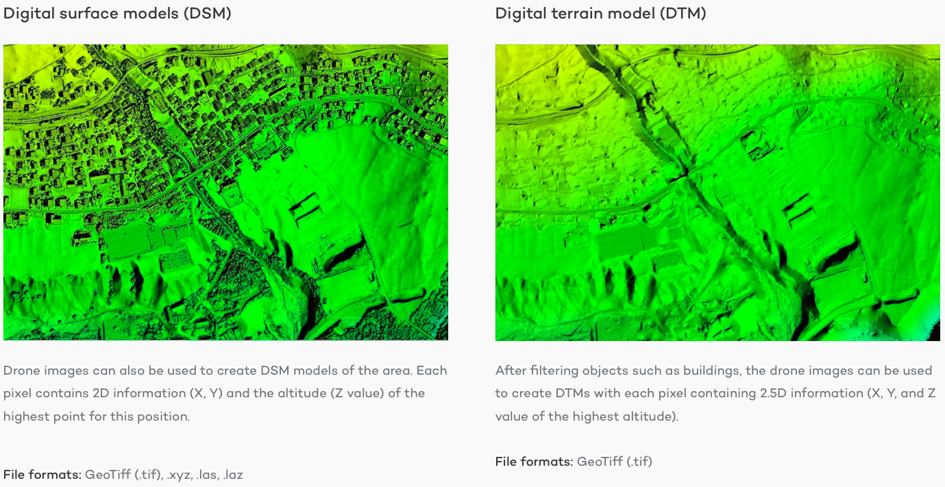
DSM AND DTM FROM DRONE SURVEY

CONTOUR FROM DRONE SURVEY
Accuracy of Drone Survey ?
The quality of camera resolution, the height at which the drone flies and the method and technology used to geolocate the aerial images can heavily influence the accuracy of drone survey mapping. At this point, it is possible to reach an absolute accuracy down to 2-5 cm .
Drone Survey Methodology ?
Before leaving the office for Drone Survey, the team does initially prelimarily survey with google earth for checking the obstructions and site accessibility .
After reaching the site, team start with putting the DGPS base and take the RTK values at regular intervals. After all the values are picked across the area of interest, than aerial images are captured with the help of Drones . With the help of photogrammetry softwares like Pix4D or agisoft, dgps and drone data are merged together to form a seamless orthomosaic or 2D map. You can achieve accuracy of upto 2-5 cm.
Cost for Drone Survey in Srinagar ?
Getting a Drone survey is extremely cost effective. However the costing for doing the Drone Survey in Srinagar depends on various factors like type of terrain, outputs of drone survey, weather etc. However the Drone survey costs around Rs 60,000 to 75,000 per sq km.
We provide services at following locations –
Summary :
Drone Survey in Srinagar with the help of DGPS and quadcopter is a technical process but it saves lot of time and it is extremely cost effective. Atom Drones has been doing Drone Survey in Srinagar for many years. Drone Survey gives so many outputs in just single flight like Orthomap, DEM, DTM, DSM, Contour etc.
