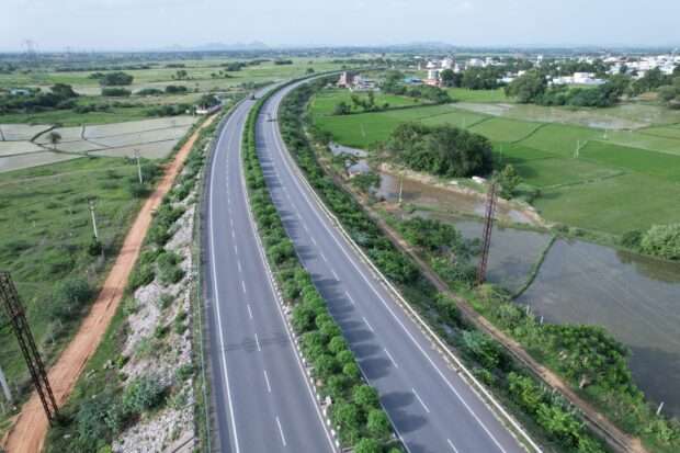
Drone Survey Technology in the Roadways Industry
Revolutionizing the Roadways Industry with Drone Survey Technology
The integration of drone survey technology in the roadways industry has instigated a new dawn in infrastructure planning, construction, and maintenance. Atom Aviation, a leading provider in this sector, has been at the forefront of leveraging this technology to deliver comprehensive and accurate data for various road projects, leading to efficient planning and reduced costs.
The Remarkable Benefits of Drone Survey Technology
The utilization of drone survey technology by Atom Aviation has revolutionized the roadways industry on multiple fronts:
- Improved Efficiency and Reduced Costs: Drone surveys require less manpower and resources, resulting in significant savings.
- Enhanced Accuracy: The high-resolution imagery and data collected are vastly superior to traditional methods.
- Increased Safety: With drone surveys, there’s no need for personnel to access dangerous or hard-to-reach areas.
- Environmental Impact: Drone surveys cause minimal disruption to the natural environment and local communities.

Atom Aviation: Pioneering Drone Survey Technology in the Roadways Industry
Atom Aviation has been instrumental in harnessing the power of drone technology to offer advanced surveying solutions. Our dedication to innovation and commitment to quality has made us a trusted partner for many in the roadways industry.
Here’s how Atom Aviation is making a difference:
- We offer customized drone survey solutions tailored to meet unique project requirements.
- Our team of experts ensures meticulous data collection and analysis for precise results.
- With Atom Aviation, you receive end-to-end service from initial consultation to final report delivery.
The Rising Role of Drone Survey Technology in the Roadways Industry
The roadways industry has come a long way, with technological advancements playing a significant role in transforming its landscape. One such development that is making massive strides in this sector is drone survey technology. This technology offers a plethora of benefits:
- Enhanced Safety: Drones can reach areas that are challenging and hazardous for human surveyors, thus reducing the risk of accidents.
- Increased Efficiency: Drone surveys can cover large areas in minimal time, making them significantly more efficient than traditional survey methods.
- Improved Accuracy: Drones are equipped with high-resolution cameras and advanced sensors that provide accurate and detailed data.
The Impact of Drone Survey Technology on Road Construction and Maintenance
Drone survey technology has revolutionized road construction and maintenance processes:
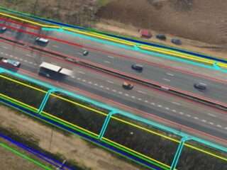
- Planning and Design: Drone surveys provide a comprehensive 3D mapping of the project area, aiding in effective planning and design.
- Construction Monitoring: Drones can monitor construction progress in real-time, ensuring the project is on schedule and within budget.
- Maintenance: Regular drone surveys can identify potential issues before they turn into major problems, thus facilitating timely maintenance.
Future Prospects of Drone Survey Technology in the Roadways Industry
The future of drone survey technology in the roadways industry is undoubtedly bright. Here are a few prospective developments:
- Autonomous Drones: Autonomous drones could perform regular surveys without human intervention, further improving efficiency and safety.
- Advanced Data Analysis: With the integration of AI and machine learning, drones will be able to analyze the collected data and provide insightful predictions.
- Widespread Adoption: As the benefits of drone survey technology become more evident, we can expect more widespread adoption in the roadways industry.
Navigating Regulatory Hurdles for Drone Survey Technology
Despite its immense potential, drone survey technology faces regulatory challenges. Addressing these will be critical for its successful implementation:
- Privacy Concerns: Striking a balance between drone operations and privacy rights will be crucial.
- Airspace Management: Ensuring safe drone operations in shared airspace is essential, requiring effective regulations and control measures.
- Licensing and Certification: Establishing clear guidelines for drone operators’ licensing and certification will help ensure safety and professionalism in the sector.
Integrating Advanced Technologies with Drone Surveys in the Roadways Industry
With the evolution of technology, the use of drones in the roadways industry isn’t solely limited to surveying. Several advanced technologies can be integrated with drones to optimize efficiency and improve results.

- Lidar Technology: Lidar (Light Detection and Ranging) technology can be mounted on drones to produce detailed 3D models of the surveyed area. In the roadways industry, this can be used for route planning, terrain modeling, and volume calculations.
- Thermal Imaging: Thermal cameras on drones can detect heat anomalies in road surfaces, identifying potential issues like water leaks, insulation gaps, and more. This can lead to more efficient maintenance and lower repair costs.
- High-Resolution Photogrammetry: Drones equipped with high-resolution cameras can generate high-quality aerial imagery, providing a comprehensive view of the project area. This can aid in everything from land acquisition to construction monitoring.
Utilizing Drone Survey Technology in the Roadways Industry
Implementing drone survey technology in the roadways industry can be done in several ways:
- Pre-Construction Planning: Drone surveys can provide critical data for initial project planning, giving an accurate view of the terrain and other environmental factors.
- Construction Phase: Drones can monitor construction progress, providing real-time data and identifying any deviations from the plan. They can also aid in ensuring worker safety on the construction site.
- Post-Construction Evaluation: Drones can conduct a final survey after project completion, evaluating the quality of the work and identifying any potential issues.
- Routine Maintenance: Regular drone surveys can help to monitor the condition of roads over time, allowing for the early detection of problems and timely maintenance.
In essence, by integrating advanced technologies with drone surveys, the roadways industry can leap towards improved efficiency, safety, and overall project outcomes. The use of drones in the roadways industry is no longer a question of if, but when, and how.
In conclusion, drone survey technology offers an effective, efficient, and safer solution for data collection in the roadways industry. As we continue to explore its potential, Atom Aviation remains dedicated to delivering exceptional results that drive project success.
Contact Us
Registered address:
- E-523, Ramphal Chowk, Dwarka Sec 7, New Delhi 110075
- +91- 9654450079
- contact@atomaviation.com

